Trusted European
Intelligence.
Wide area surveillance.
Target-level precision.
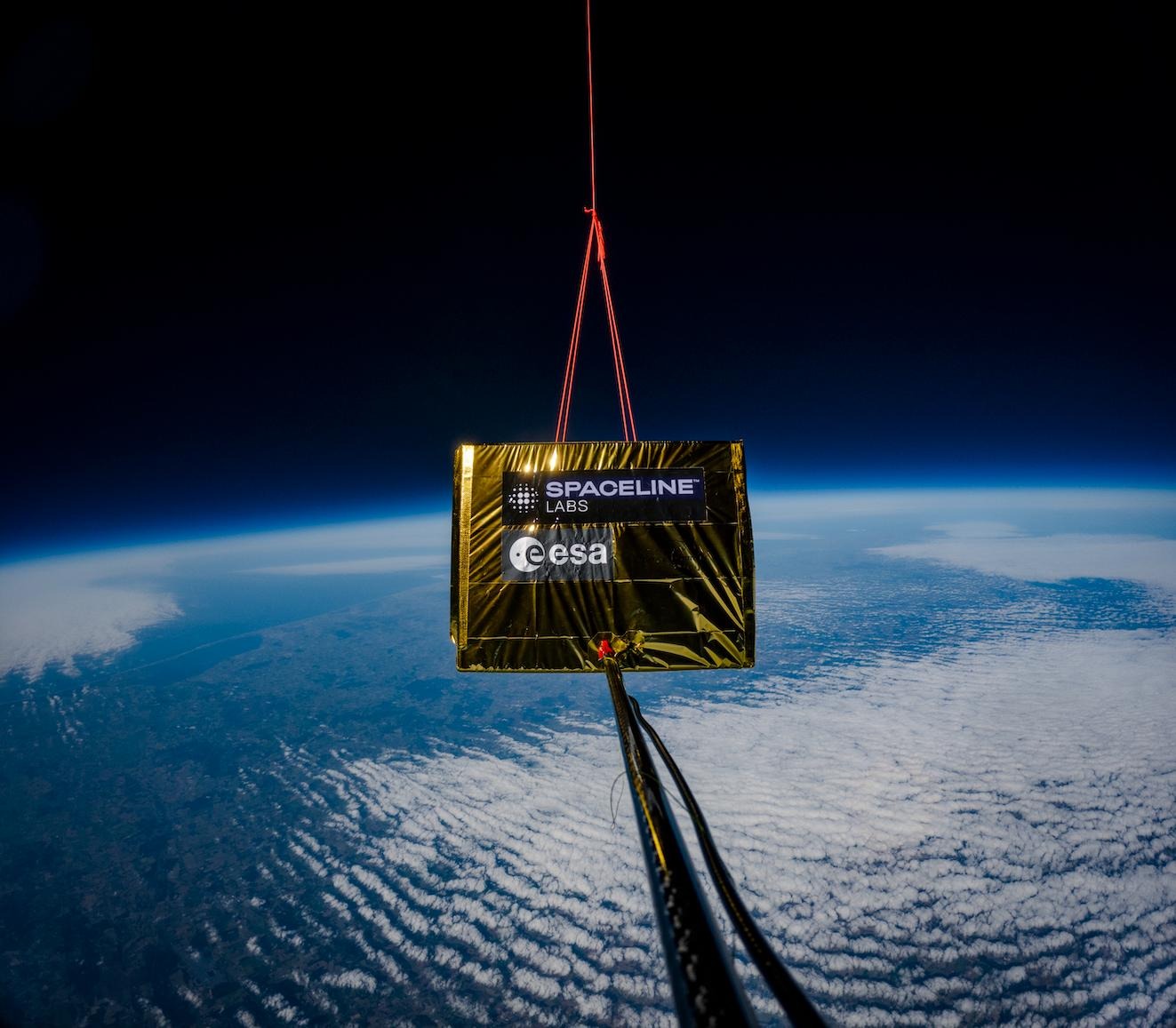
PANTHERA
Panthera, our flagship stratospheric platform for long endurance, accurate control and high persistency. Operating in fleets or as standalone missions.
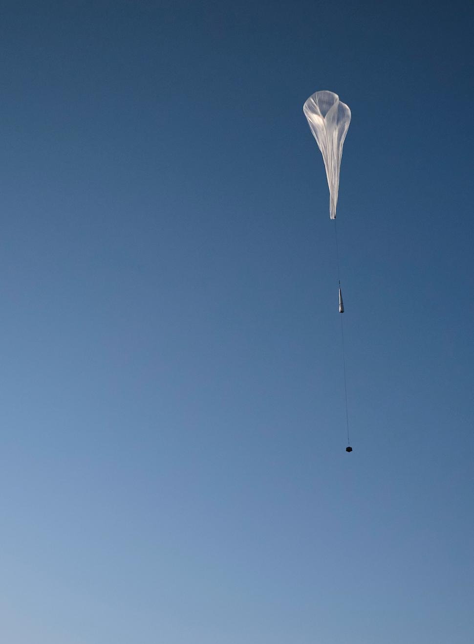
JAGUAR
Our smallest Lighter-Than-Air (LTA) platform for fast tactical deployment, high coverage and ultra precise targeting.
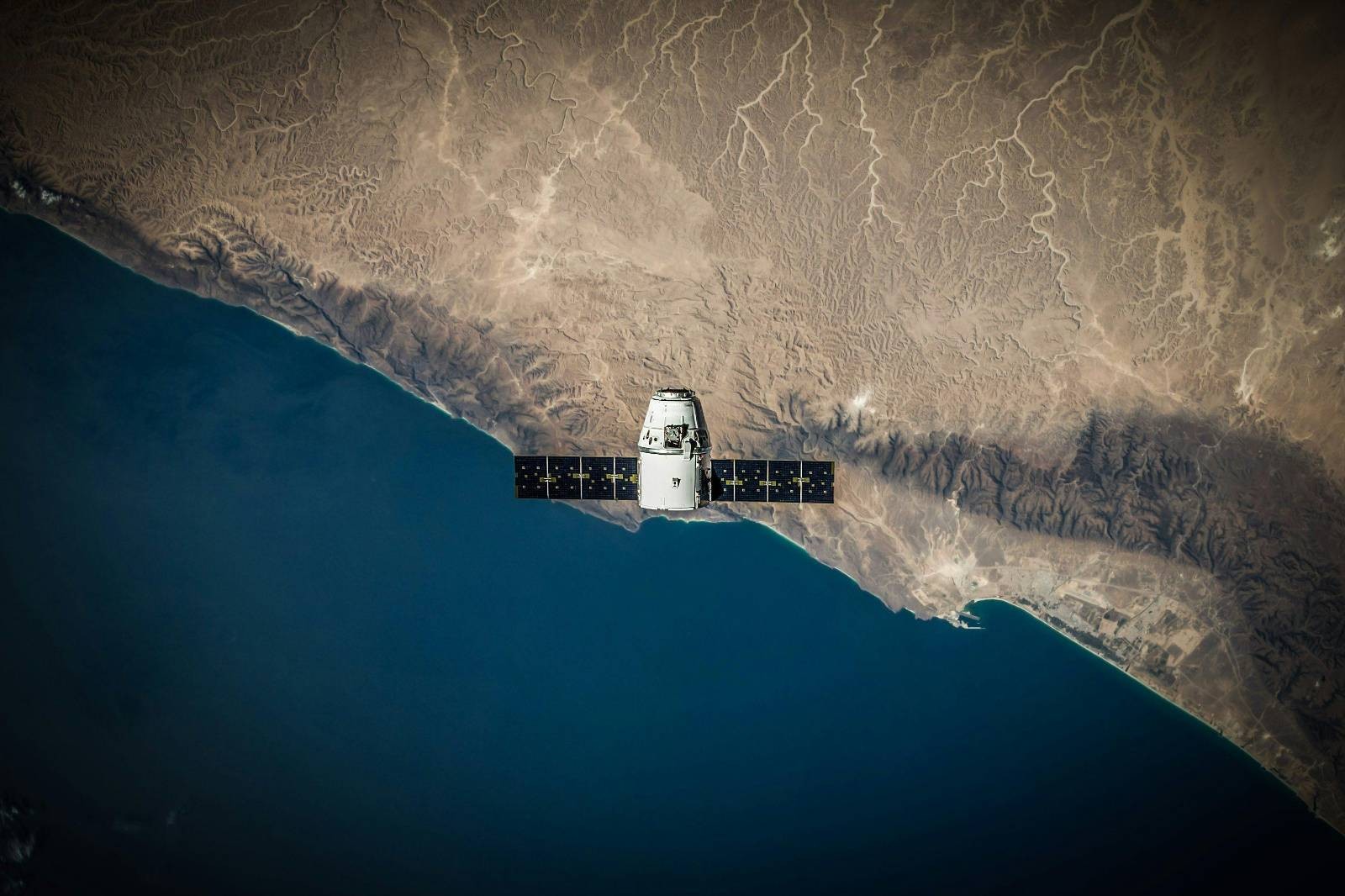
VIRTUAL CONSTELLATION
With access to tasking and configuration of more than 300 satellites, the virtual satellite constellation delivers a wide range of optical and radar data.

160–2000 km
Low Earth Orbit
12–50 km
Stratosphere
10 km
Commercial Aviation
0 km
Ground
Unlocking the
Stratosphere
Enabling an entirely new vantage point for intelligence in the world’s most underutilized airspace.

our software suite provides
Solutions, not pixels
APEX Software Suite
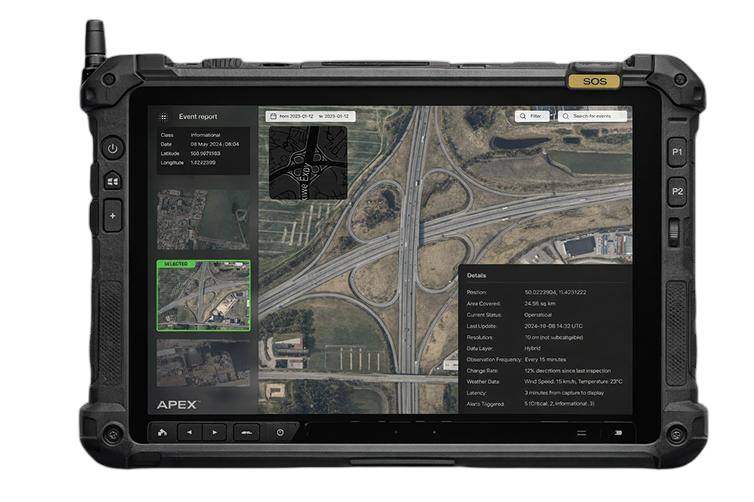
Apex Tactical is our rugged command-and-control system, giving field operators real-time access to live data and full platform control — enabling faster decisions and precise action in mission-critical environments.
APEX Software Suite
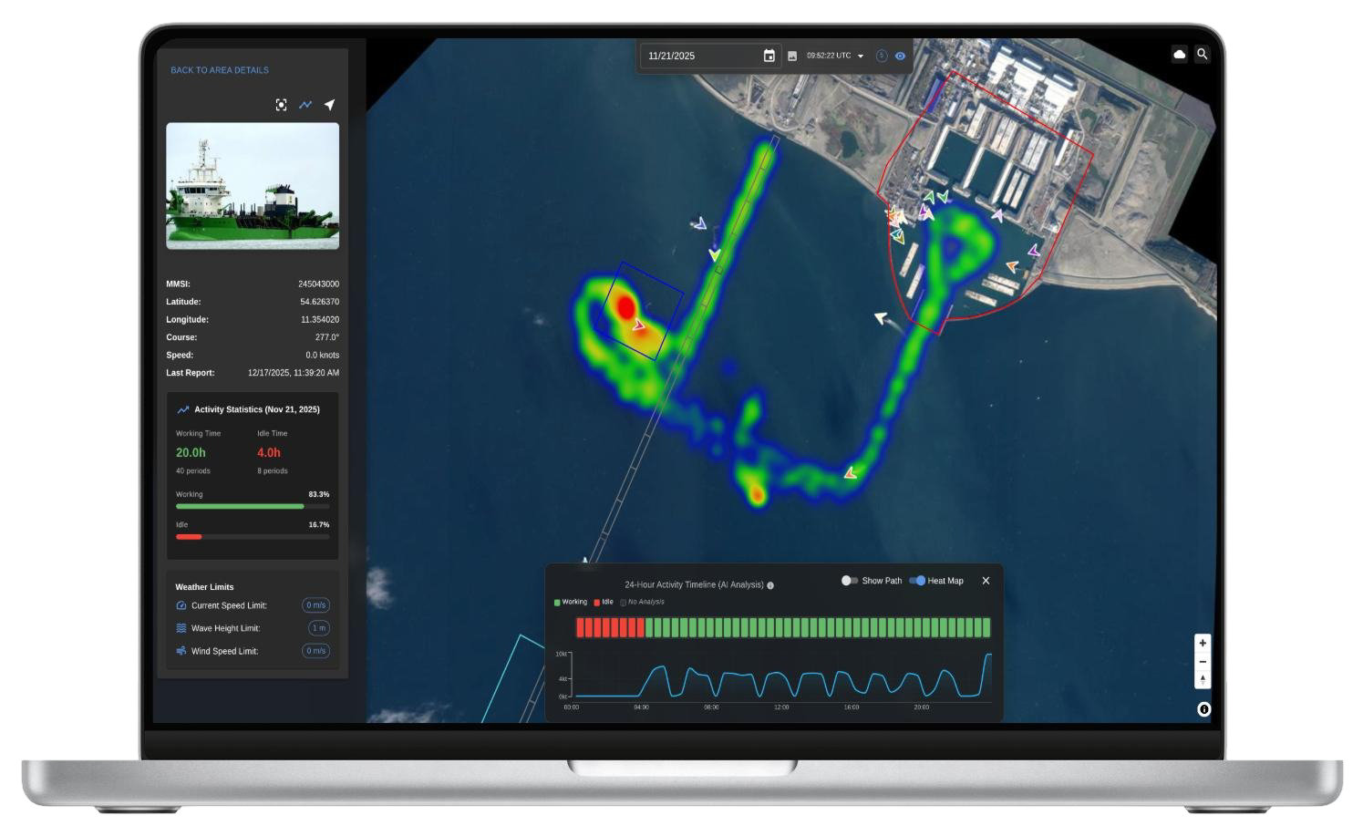
Apex Intelligence is our analytics platform, transforming captured space- and stratospheric data into actionable insight through advanced AI, 3D modeling, and automated processing — delivering clarity long after missions end.
Mission
SpacelineestablishesEurope’ssovereignpresenceandaccesstothestratosphere.Fromrapidlydeployablemonitoringsystemsfortacticalforcestolarge-capacitystratosphericplatformswithadvancedcontrolandenduranceforstrategicusers,theSpacelineinfrastructureextendsbeyondtraditionalISR.
Spacelineprovidethetrustedinsightandmissioncapabilitiesthatenhancedeterrence,resilience,andoperationalreadinessforEuropeandNATO.
Speed of Deployment
Builtfast.
From Formation to Flight
Regulatory approvals secured and first prototype launched past 100,000 feet within 60 days of founding.
Get in Touch
MissionReady?
We support defense forces, law enforcement, maritime authorities, and emergency agencies with resilient capabilities that strengthen national readiness and response.